
Topography – DIY?
A few years back I saw a kickstarter for a small bluetooth puck that connected to a mobile phone and could be used to accurately measure spaces, outdoor, indoor and topography. At the time I had no need, although the price was ~£200. Now with need I found the device once again in it’s second iteration, but now £839. It’s called Moaesure and captures X, Y, and Z (elevation) coordinates, when the puck mounted on the bottom of a pole and phone on top, is moved from one place to another.

Understanding the topography of a site is fundamental to the successful execution of any barn conversion project. Precise measurements of land elevations and gradients underpin architectural design, ensure regulatory compliance, and facilitate effective land management strategies.
The Critical Role of Topographical Data
During our previous self-build project in a conservation village, stringent height restrictions prohibited us from exceeding the height of the neighbouring Vicarage. This limitation underscored the necessity for exact topographical data to determine excavation depths, which, in that instance, required more than two meters of earth removal to accommodate a three-story structure.
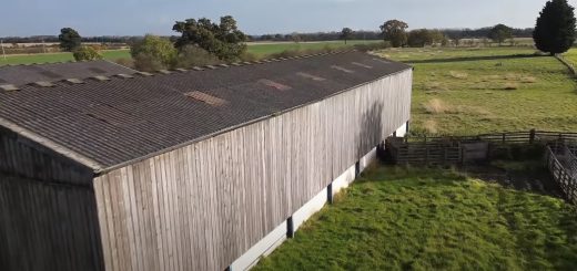
In our current Class Q barn conversion, we are bound by the existing barn portal, with no possibility of reducing the floor level. The barn extends 30 meters along a gradient of 1.67%. The addition of insulation and floor finishes will inevitably raise the internal floor height, thereby constraining the available ceiling height on both ground and first floors. Beyond the structure, the surrounding acre of agricultural land is prone to flooding, necessitating strategic drainage interventions.
Evaluating Moasure: A Contemporary Measurement Solution
In exploring methods to conduct the topographical assessment, we encountered Moasure. This innovative, motion-based measuring device records x, y, and z coordinates, capturing precise measurements of distances, areas, and elevations by tracking the device’s movement across the terrain.
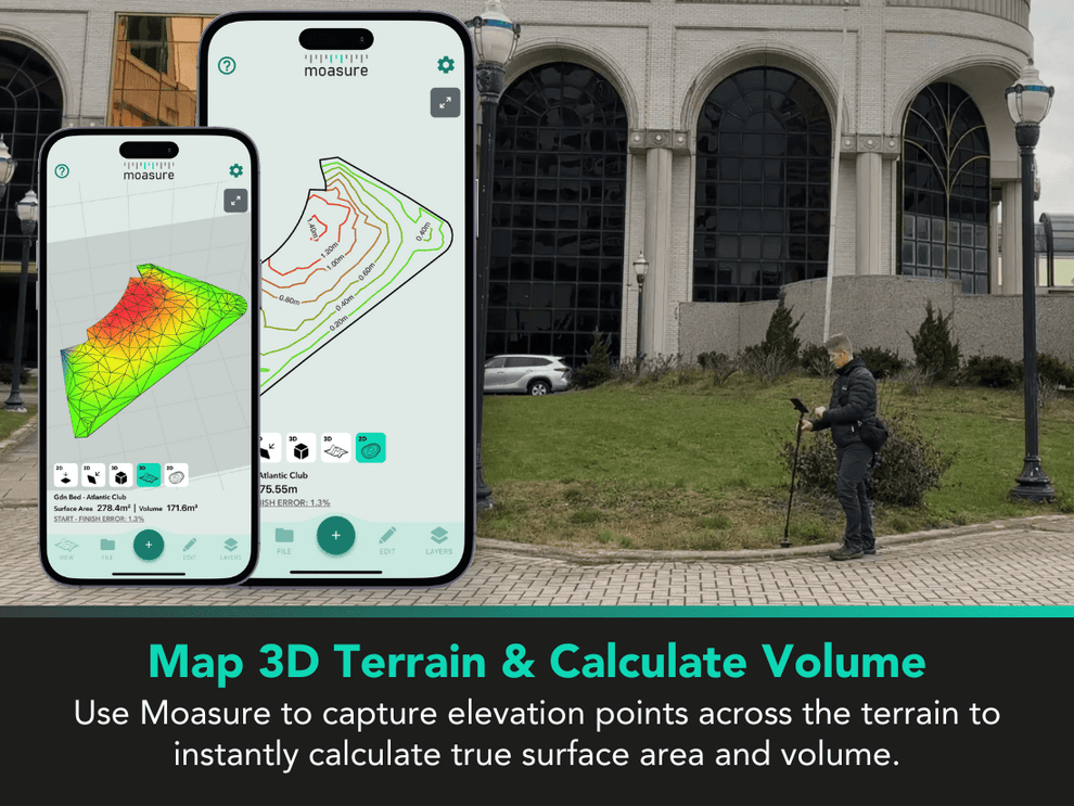
Moasure presents several compelling advantages:
- Efficiency: Moasure simplifies and expedites the measurement process, significantly reducing the time and labor associated with conventional techniques.
- Accuracy: Boasting an accuracy rate of up to 99.7% for linear measurements, Moasure offers high-fidelity data capture.
- Versatility: Its applicability across both indoor and outdoor environments makes it a multifaceted tool adaptable to diverse project requirements.
- Data Integration: Export options to PDF, CAD, or CSV formats streamline collaboration with architects, engineers, and contractors.
However, the price point—approximately £699—renders Moasure a considerable investment for what may ultimately be a single-use application. While such an expense may be justifiable for contractors or surveyors operating across multiple sites, as self-builders focusing on one project, the decision warrants careful deliberation. For the same cost, we could commission a professional topographical survey, raising questions about the long-term value of owning the device. At present, we struggle to foresee further applications that would substantiate the expenditure.
Nonetheless, the data procured through Moasure would be instrumental in informing our technical architect’s designs and guiding our efforts to manage the land. This could include devising drainage systems, adjusting surface levels, and introducing materials to mitigate flooding and enhance site functionality.
Assessing Moasure’s Practicality for Our Project
Moasure’s utility could manifest in several critical areas:
- Interior Assessments: Capturing the barn’s internal floor gradient and dimensions to shape decisions about floor height increments and ceiling allowances.
- Land Surveys: Generating a detailed topographical map of the surrounding agricultural land to inform the development of drainage and flood mitigation systems.
- Groundwork Planning: Equipping our architect and groundworks team with the precise data required for excavation, foundation work, and structural alignment.
Despite Moasure’s apparent benefits, we remain at a crossroads of balancing the allure of immediate in-house measurement DIY against the prudence of commissioning a professional survey. The potential exists for Moasure to streamline early planning stages, but whether this justifies the outlay and alternative of commissioning a professional survey remains uncertain.
We’d love to hear from others who have used Moasure or similar tools in their projects. Would you buy it for a single build, or is hiring a surveyor the smarter choice? Let us know your thoughts!




Recent Comments